"Urban coordinates are defined not only by their visual form but also by the public qualities of urban life they create." — Zhu Peidong

Wuhan Great River Center
Future Waterfront Urban Coordinate
Wuhan Great River Center, located on Wuchang’s prime waterfront, directly faces key CBD landmarks like the Wuhan Municipal Government and Bund Financial Center. Positioned at the Yangtze River axis core, the site is designated in Wuhan's 14th Five-Year Plan as an international metropolitan showcase, set to develop into a high-end business district driven by headquarters economies and financial clusters.
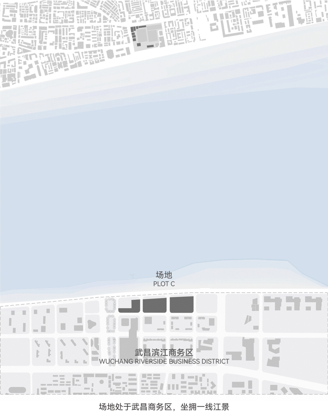
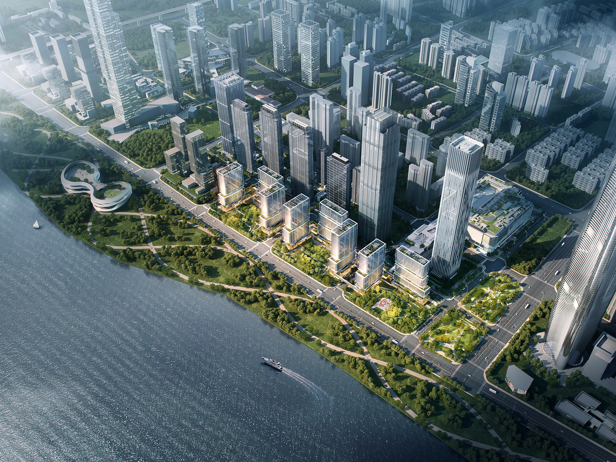
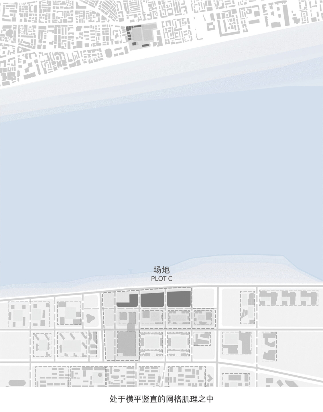
The Great River Center covers 194,000 sqm, with prior phases featuring a 380-meter office tower, commercial center, and high-end residences. Plot C, the last undeveloped waterfront site, is the key urban frontage along the river, comprising two rectangular and one L-shaped subplots divided by urban roads.
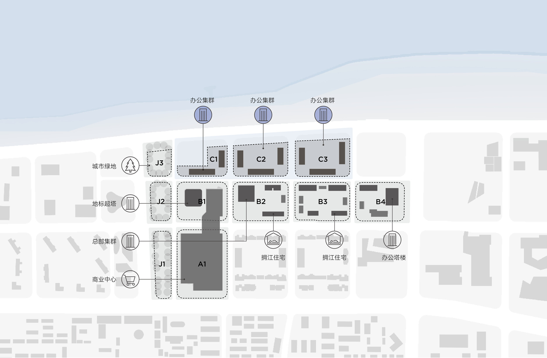
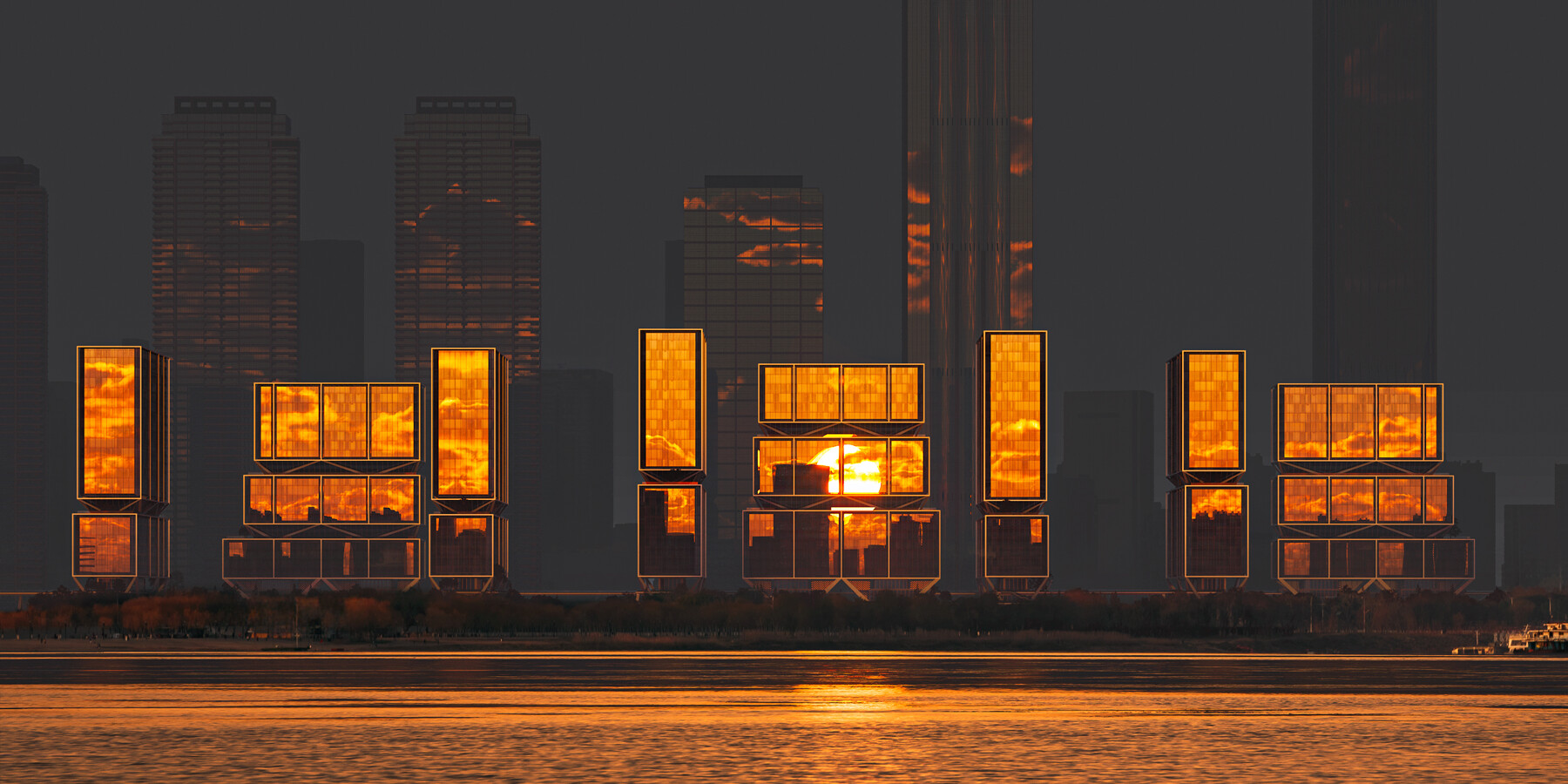
The C Plot, as the core riverside location of the Yangtze River Center, has the potential to become a new urban front for Wuchang CBD. It is also a key node for the region's development, prompting multiple invitations to renowned firms for planning input. The project brief required creating a high-energy urban landmark within the constraints of a 100-meter height limit, sightline corridors, and a slab-style layout.
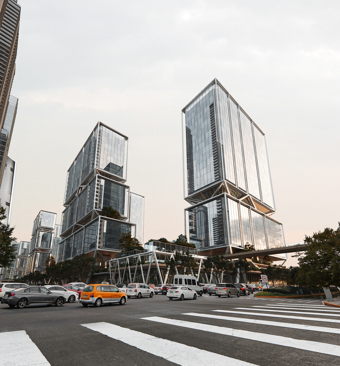
line+ Co-Founder and Chief Architect, Zhu Peidong, was invited to participate in the "Great River Center Plot C Project International Competition." As the only local design firm in this international competition, line+ competed alongside two renowned international avant-garde studios, exploring the open-ended theme of "Waterfront Urban Coordinates."
What Is the Coordinate?
An Open Cluster, A City Gathering Place
Traditional landmark buildings often stand out in terms of height or scale, symbolizing a city's or company's ambitions through formal language or symbolic and even commemorative design. However, returning to the essence of a modern city, it is about creating spaces for people to live and thrive. Unlike static city-facing buildings, we envision contemporary coordinates as both spatial markers and landmarks in the network of urban life. They should be open to the public, attracting people to gather and stay. These are dynamic urban nodes — "city gathering places." It’s not only about enhancing visual recognition but also about becoming a hub for diverse life scenarios and the vitality of civic culture.

We propose a "group" layout strategy that breaks the whole into smaller parts. This approach not only meets the site's height and volume restrictions but also better integrates with the urban fabric and the riverside environment of the Yangtze. The group layout, through a "cluster" form, enhances the multi-layered visual experience of the coordinate building, creating a more relaxed and diverse communal space that encourages varied behaviors from citizens.
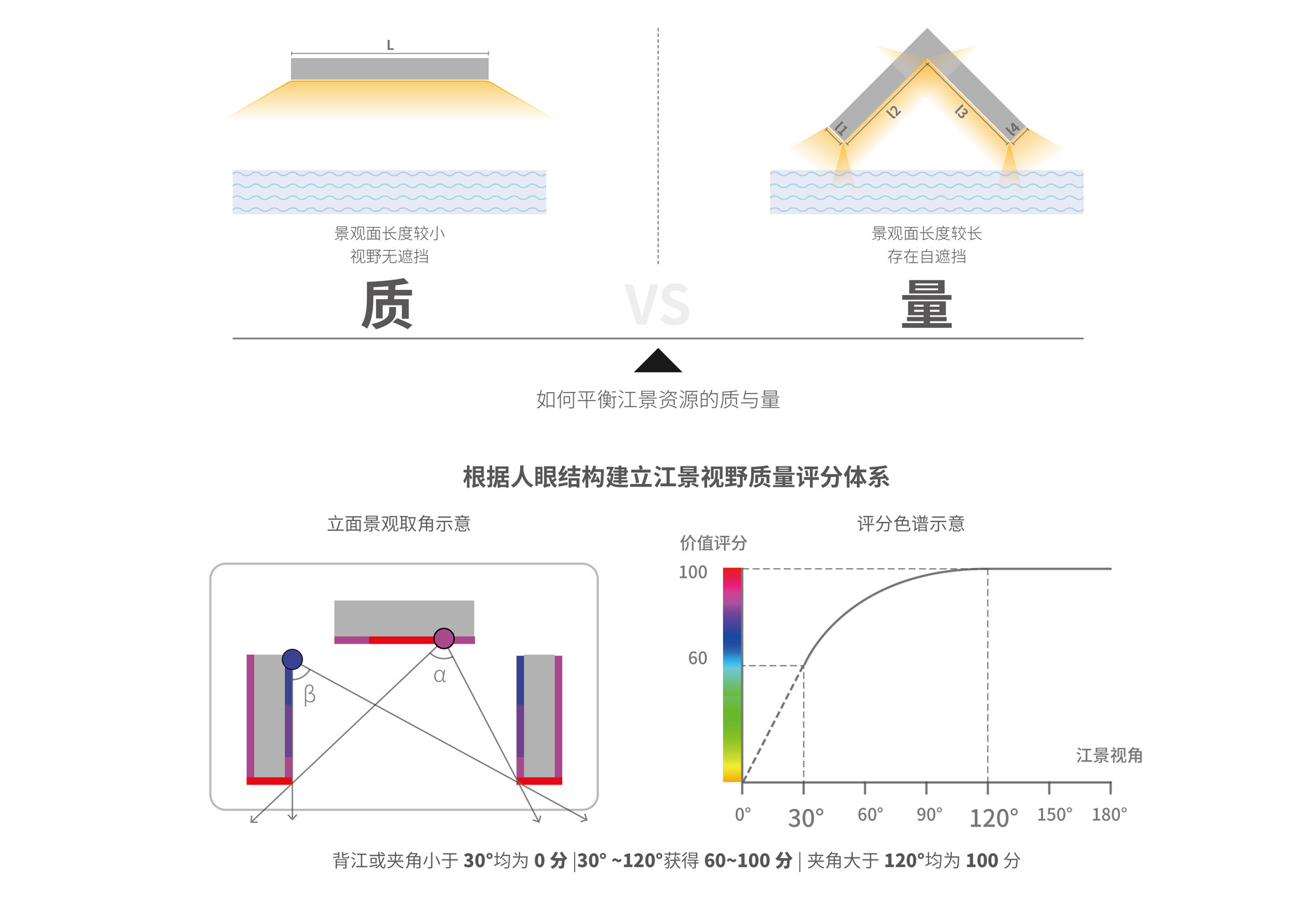
The site spans nearly 600 meters along the river. The key challenge in the design was to optimize both the project's river views and the city's scenic views. To address this, we developed a river view evaluation system based on human perspective. This system balanced factors such as building form, the quality and quantity of river views, and other elements. Considering factors like development capacity, building height, and city visual corridors, we ultimately settled on a "double U-shape + L-shape" layout.
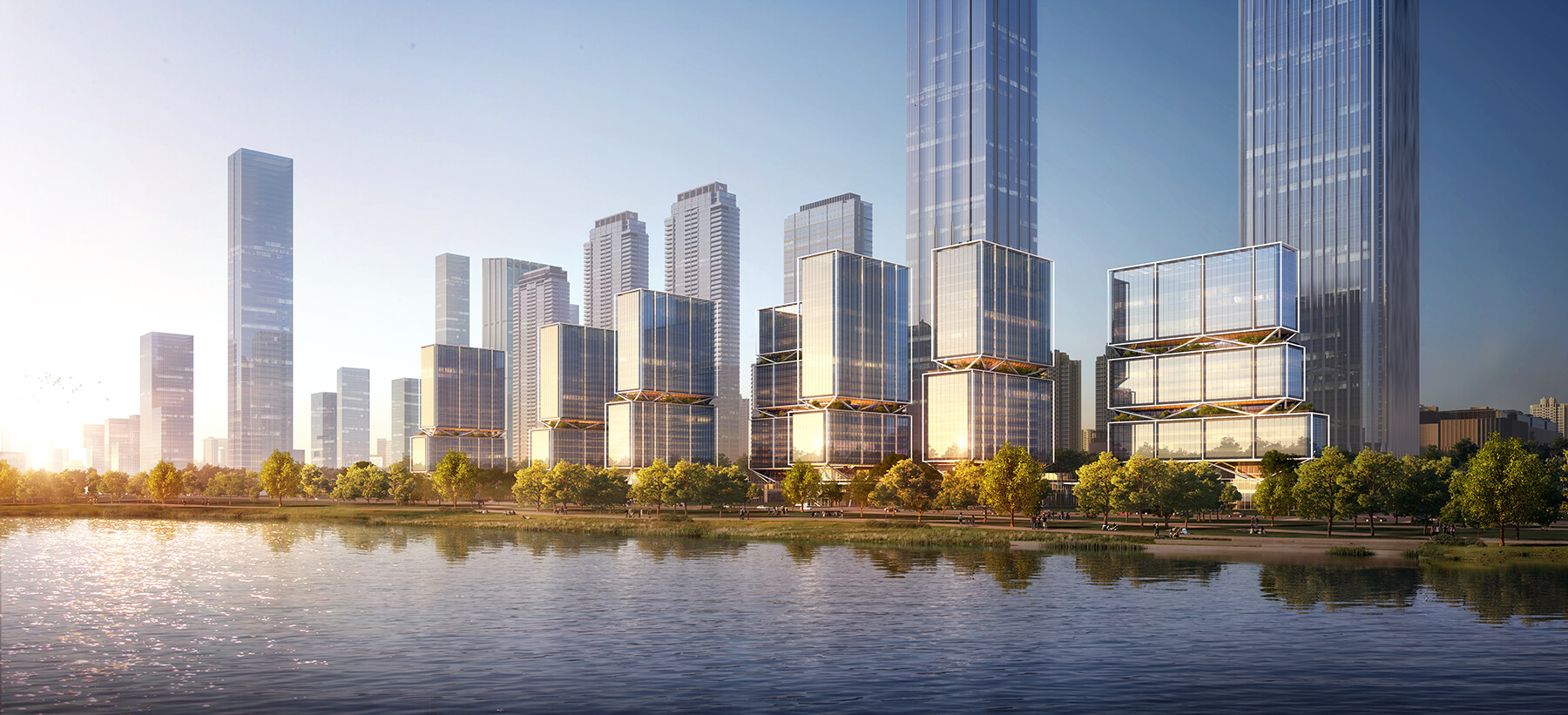

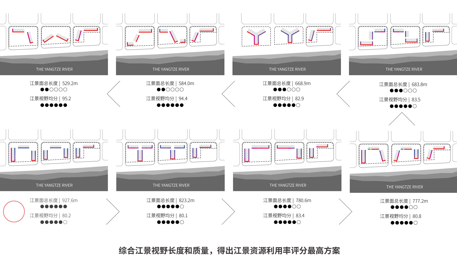

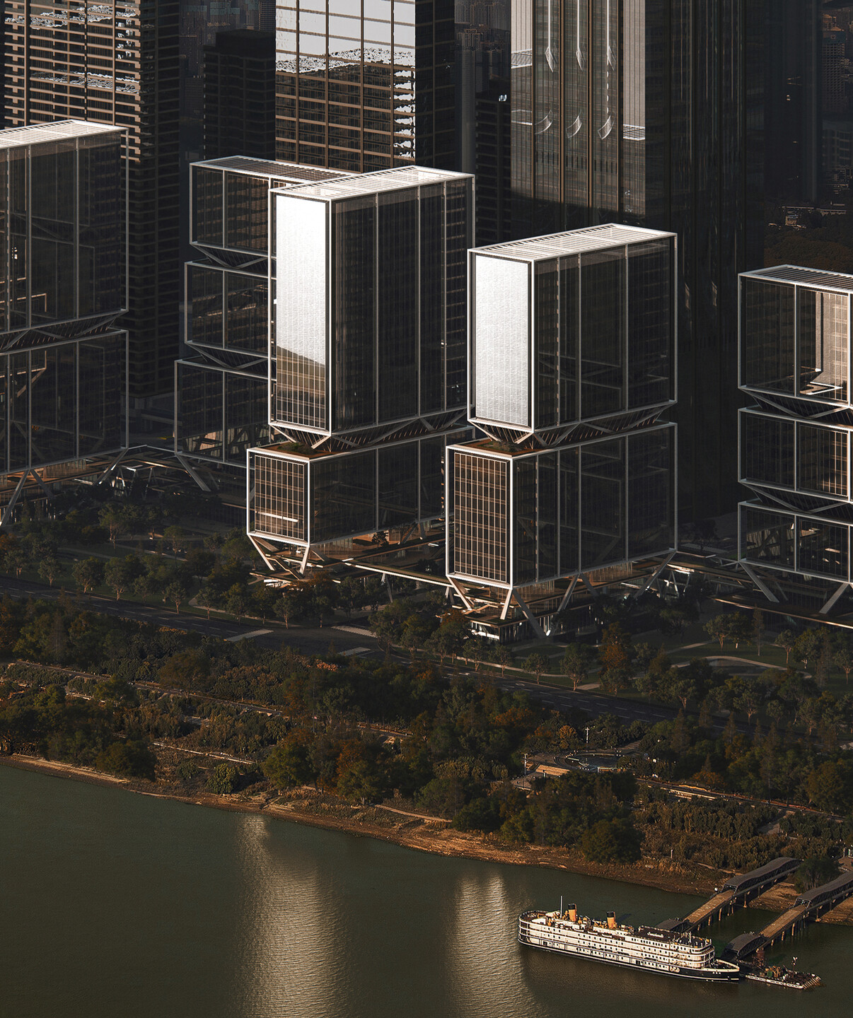
This layout not only creates favorable visual corridors for surrounding buildings, maximizing the site's river view resources, but also generates three waterfront park oases open to the public through eight high-rise towers arranged in an open yet enclosed formation, establishing a new node of urban vitality.
How to Coordinate?
Grid, Vertical, Suspended, Open
In shaping the waterfront city coordinate under the "urban gathering place" model, we conducted in-depth exploration across various scales, from regional structural organization and urban fabric continuity to architectural technical integration and spatial creation. Through the implementation of different strategies, we aim to enhance the energy density and attraction of this "urban gathering place," making it not only a visual landmark but also a perceptible and experiential coordinate building in people's memories and daily lives. The core strategies are summarized as: Grid, Vertical, Suspended, Open.
| Grid: Urban Road Network and Open Connectivity
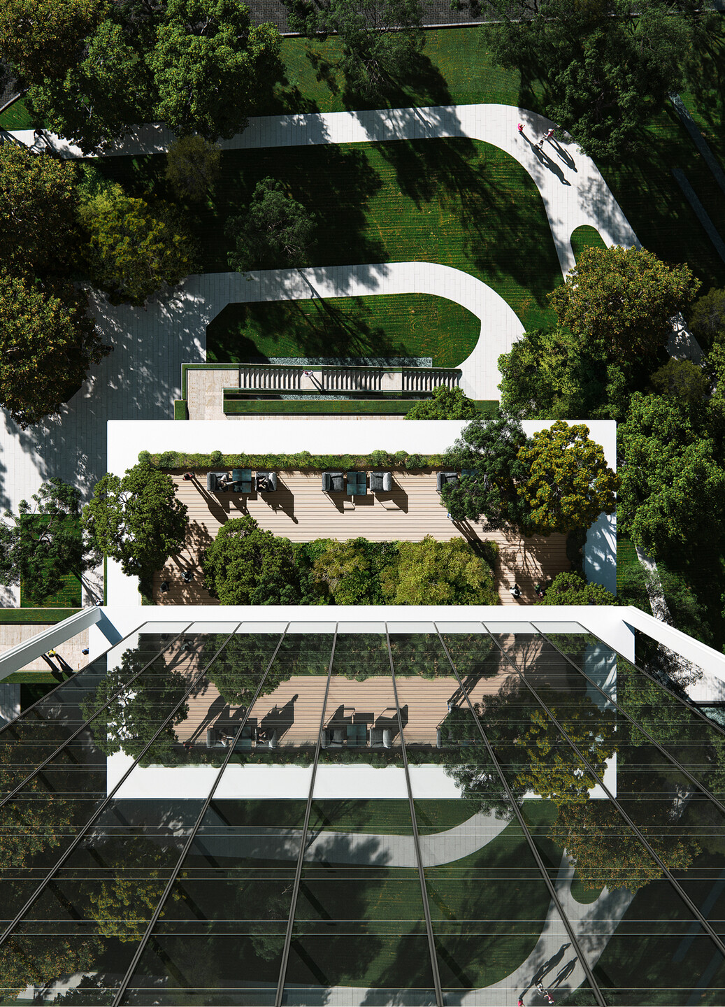
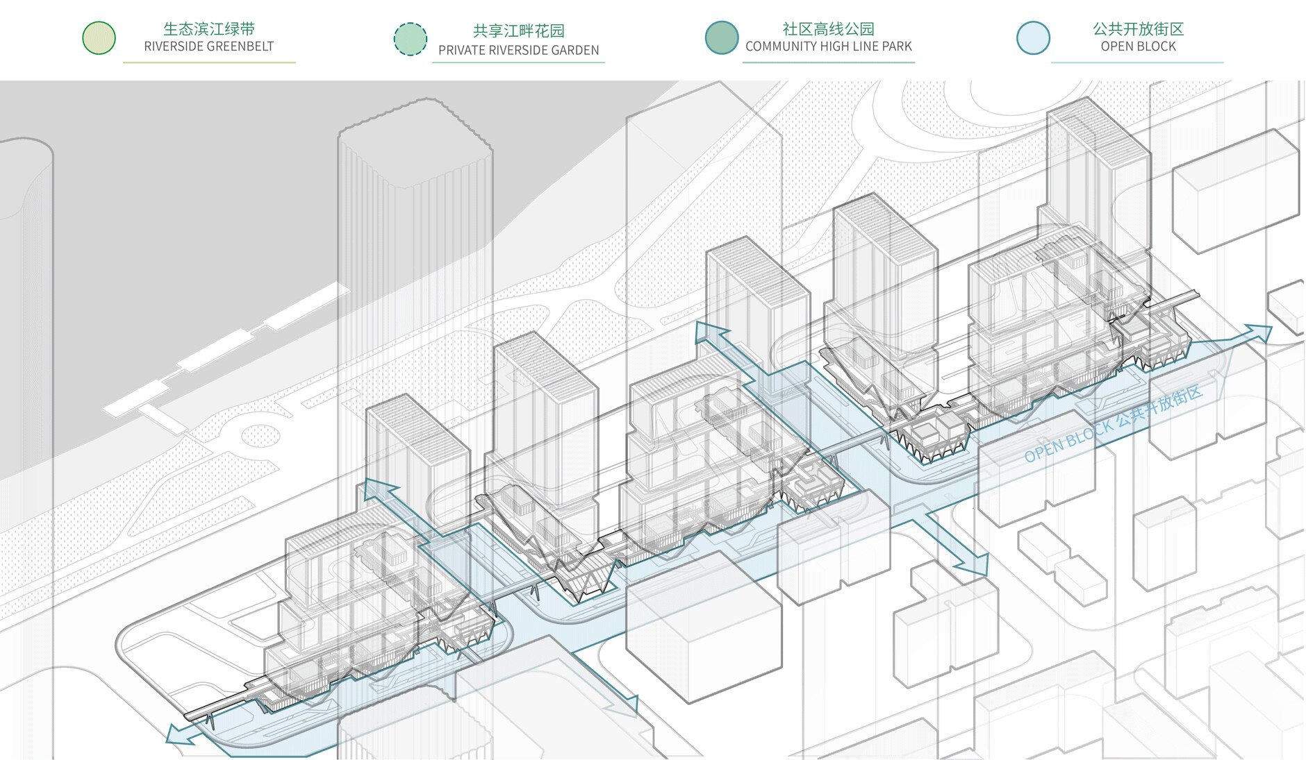
The "Double U-shape + L-shape" layout scheme aligns with the urban road network and district fabric, optimizing integration with the surrounding. The pocket-style open park, created by the setback from the Wuchang Riverside interface, forms a transitional boundary with the natural landscape, creating a space structure that harmonizes with the surrounding environment.

At the pedestrian scale, we connect the site with the surrounding urban pedestrian system by establishing a vertically layered slow-traffic network. Pedestrian bridges and ground-level cultural green corridors link the three subplots with the surrounding blocks, the MixC shopping complex, and Riverside Park. The design, with its removal of fences and open street corners, allows for multi-directional flow of people, fully realizing the site's openness and accessibility, enhancing the gathering of pedestrian activity.
| Vertical: Integrated Functions and Spatial Synergy
The master plan imposes a series of requirements for openness and connectivity on the project site. We respond to these diverse needs through a three-dimensional base, balancing openness with commercial functionality, and infusing the site with enhanced functional diversity and spatial vitality.
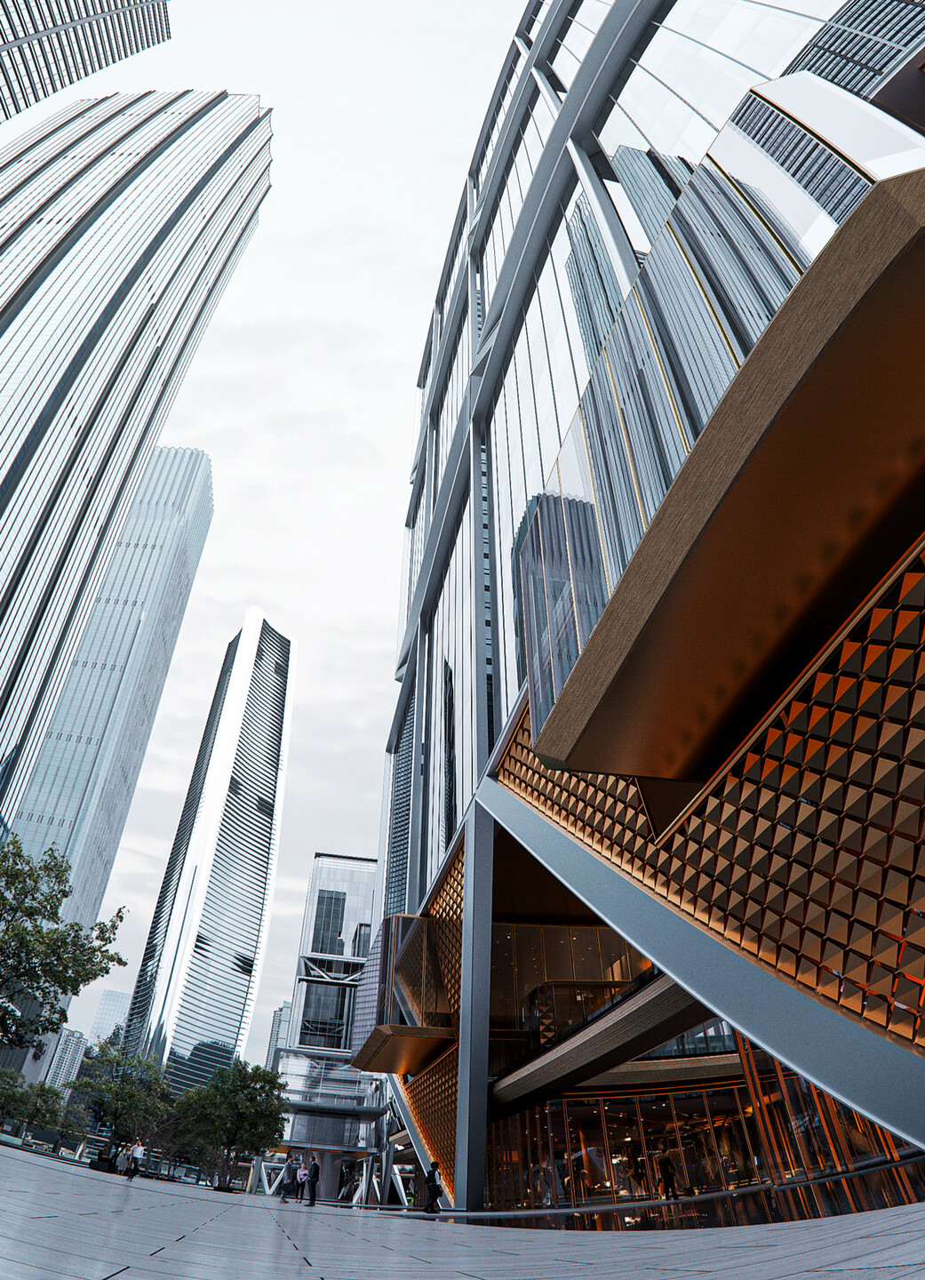
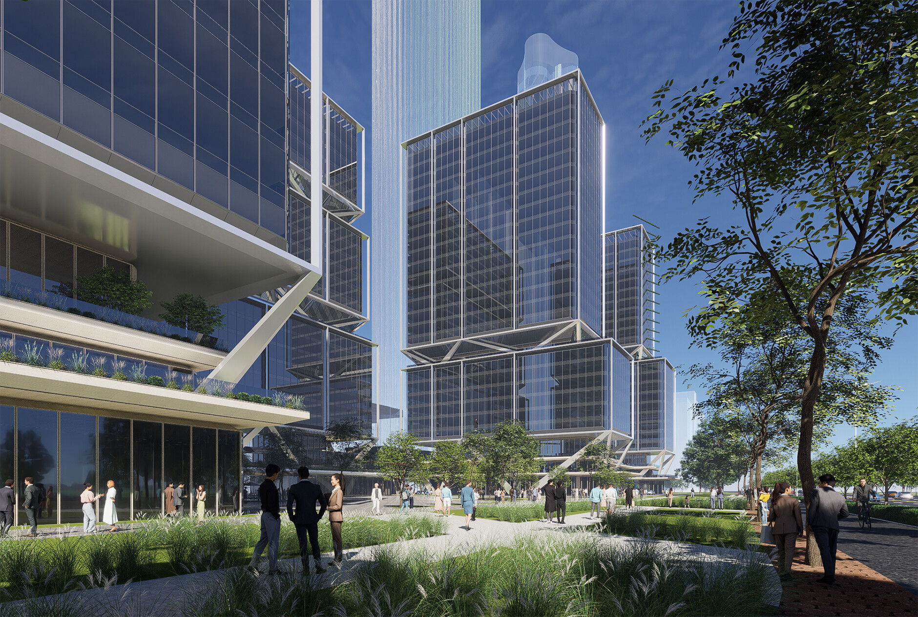
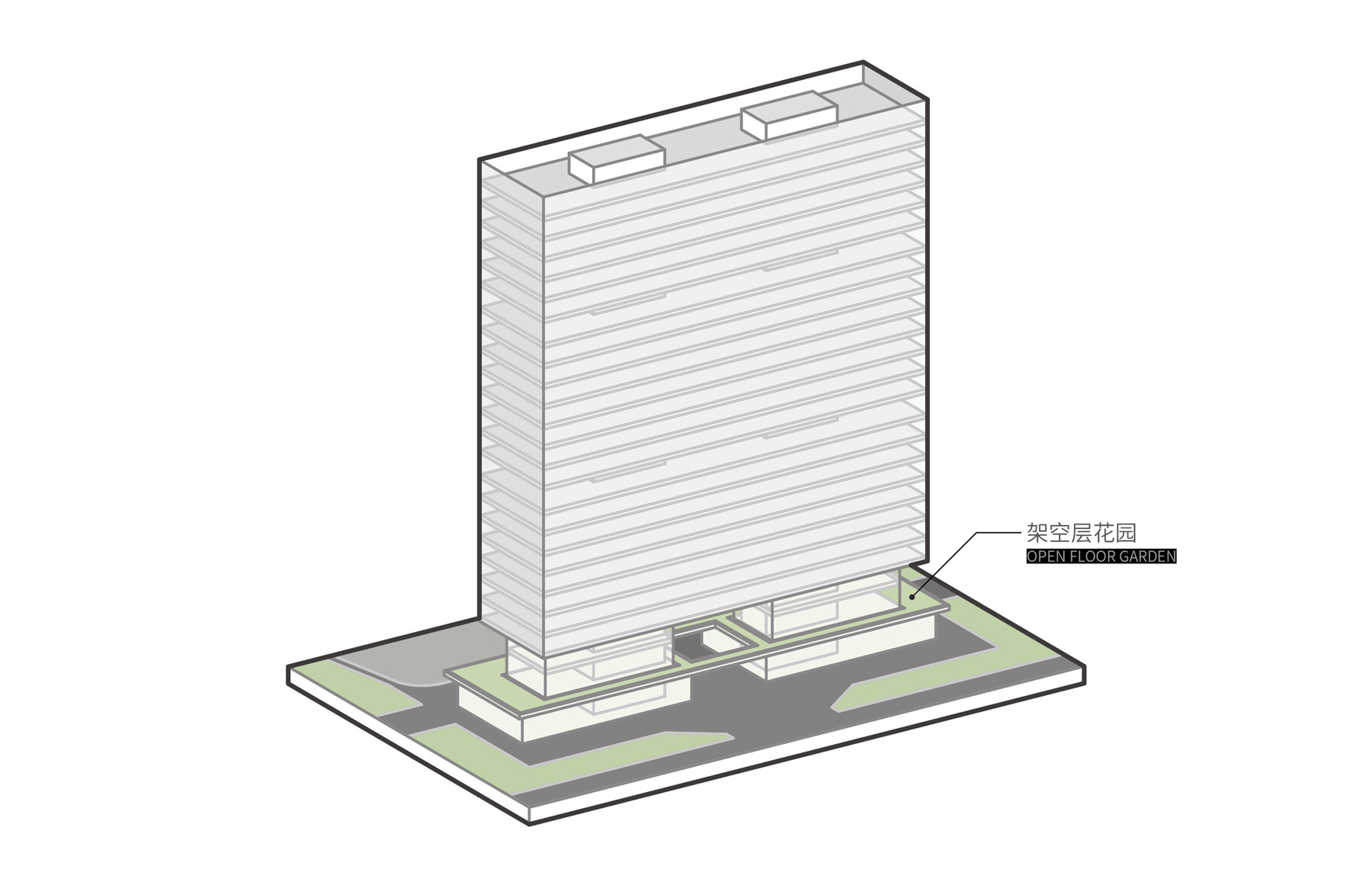
The open street level and the 6-meter-high sky street create spatial conditions for introducing diverse commercial forms, attracting foot traffic and enhancing commercial accessibility. Meanwhile, the 10-meter-high elevated park focuses on ecological optimization and improving the experience, creating a high-quality urban three-dimensional landscape public space. This setup allows for diverse flows of people, such as those for office, commercial, leisure, and residential purposes, to fulfill their needs. Through various open social spaces, it fosters interaction between different areas.

| Suspended: Technical Path and Zoning Design
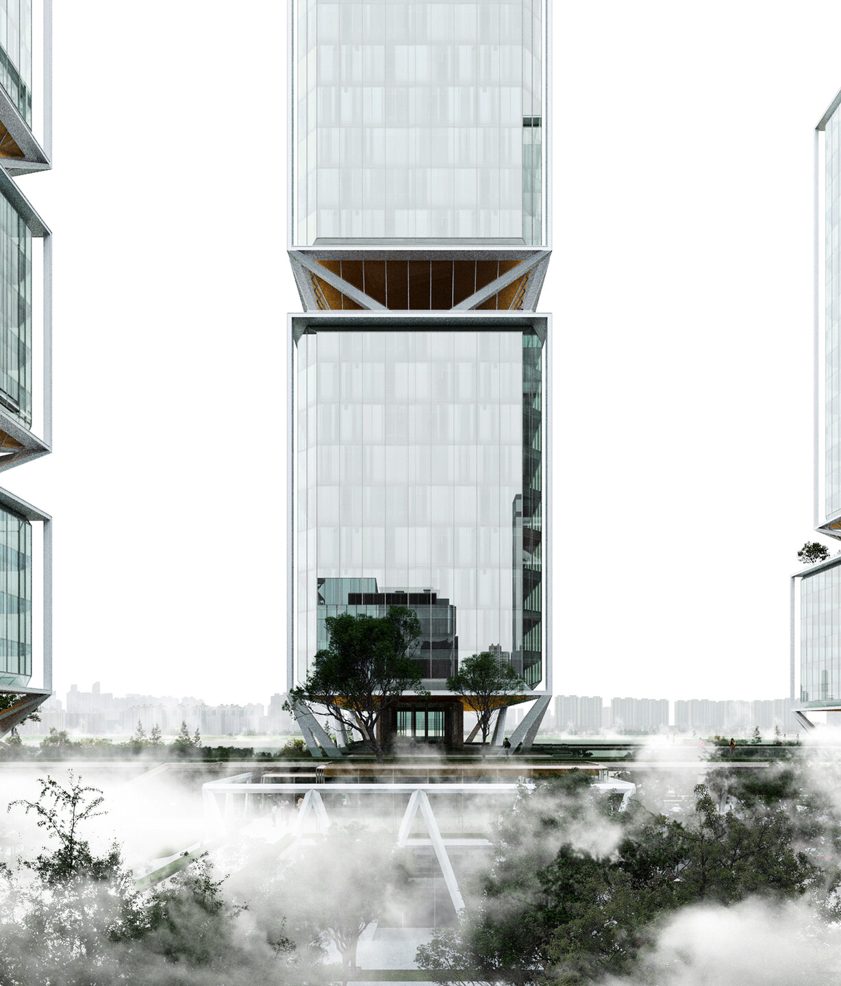
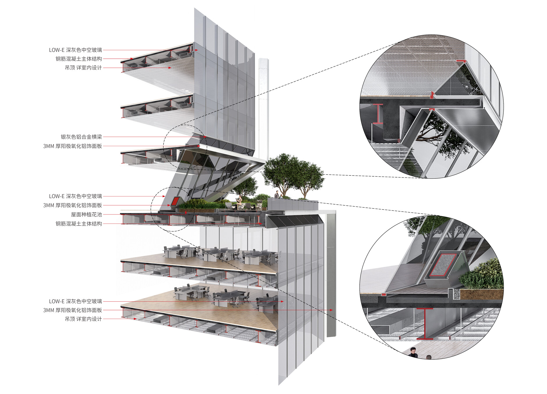
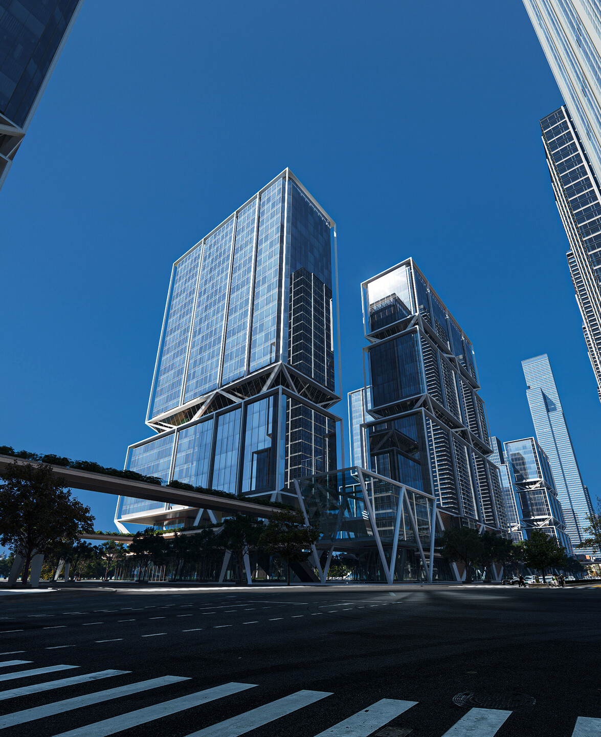
The lower area of the project serves as the main space for public participation, emphasizing openness and approachability, while the upper area primarily caters to future businesses and entrepreneurs. Given the uncertainties in the commercial office market, the design must accommodate potential future clients’ diverse and personalized needs. By matching the spatial requirements at different heights of the towers, we opted for a steel frame-concrete core tube structural system. This system effectively transfers loads using the core tube and Y-shaped inclined columns within the vertical transportation core, creating three platforms in the form.
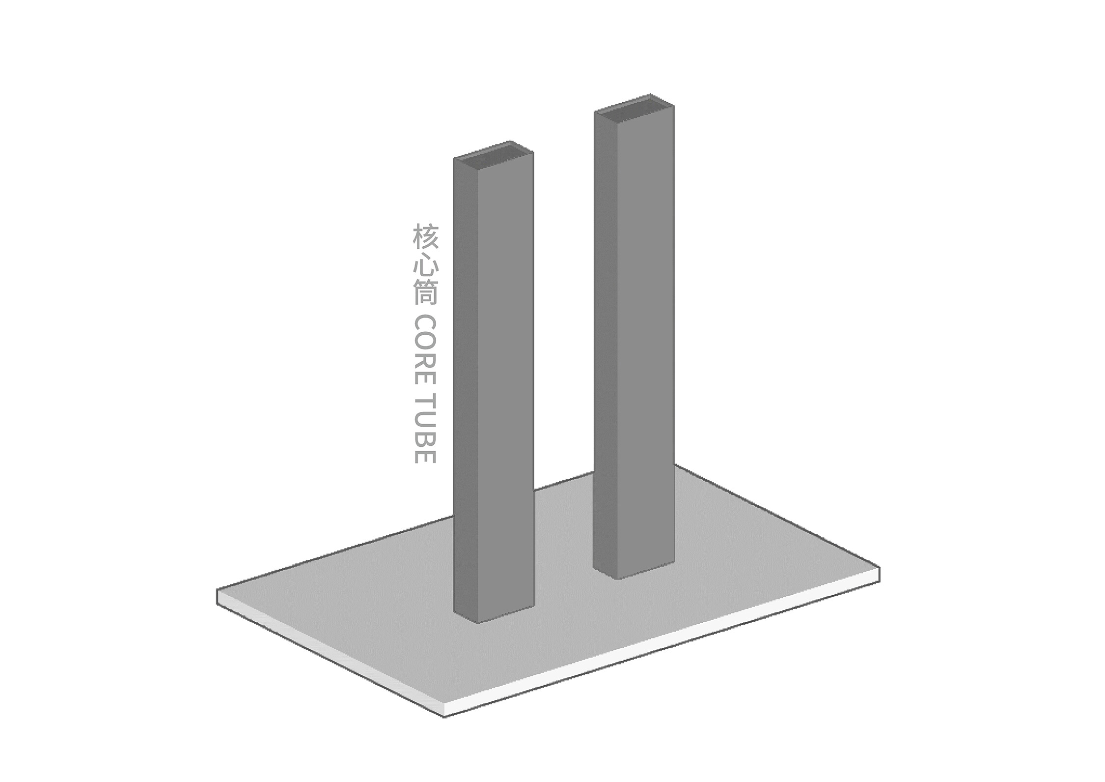
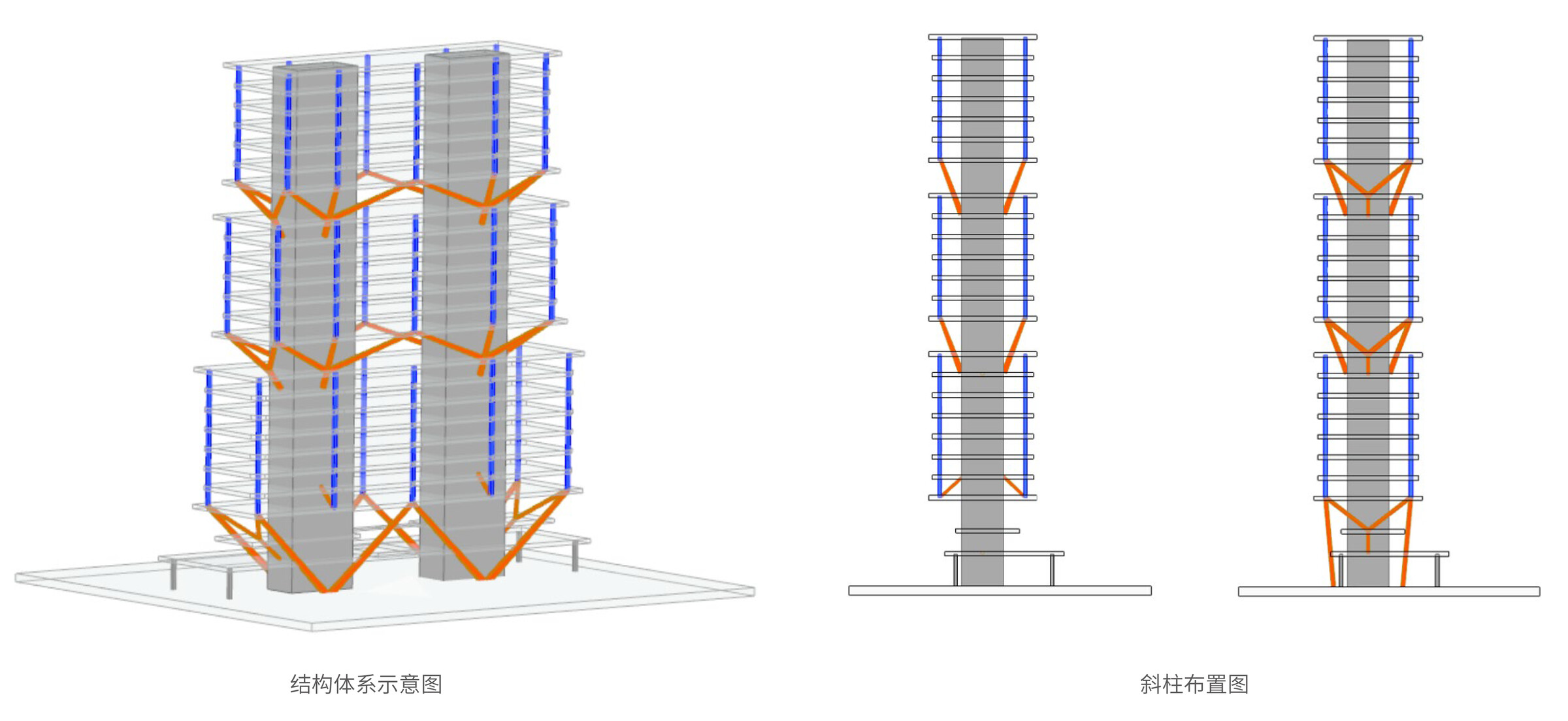
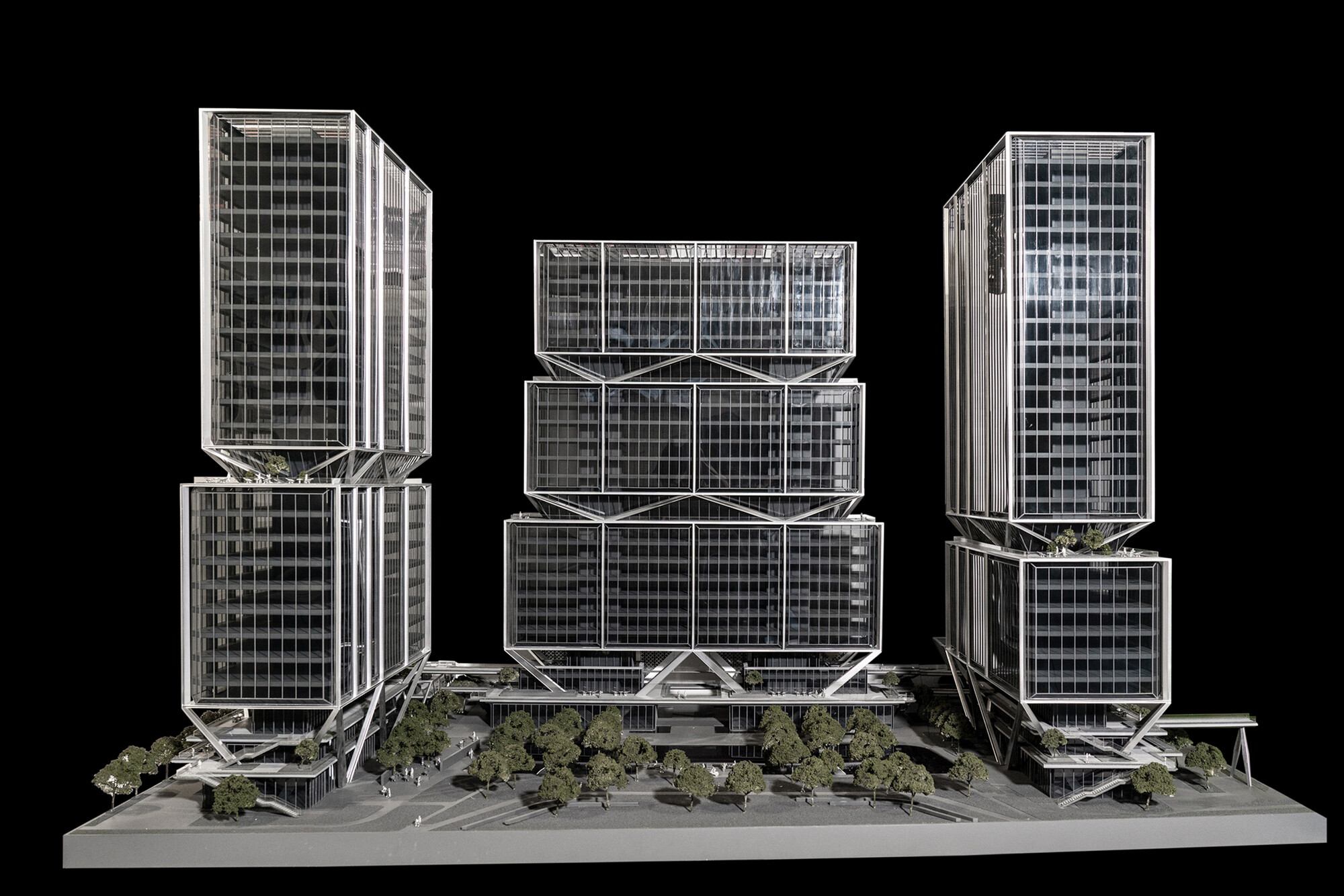
This structural design makes the high-rise buildings "suspended" above the site and the three-dimensional base. It ensures the continuity and integrity of traffic in the lower zone while avoiding common supporting structures like columns in the standard floors. This maximizes the river view and leaves flexible space for future uncertain usage scenarios.

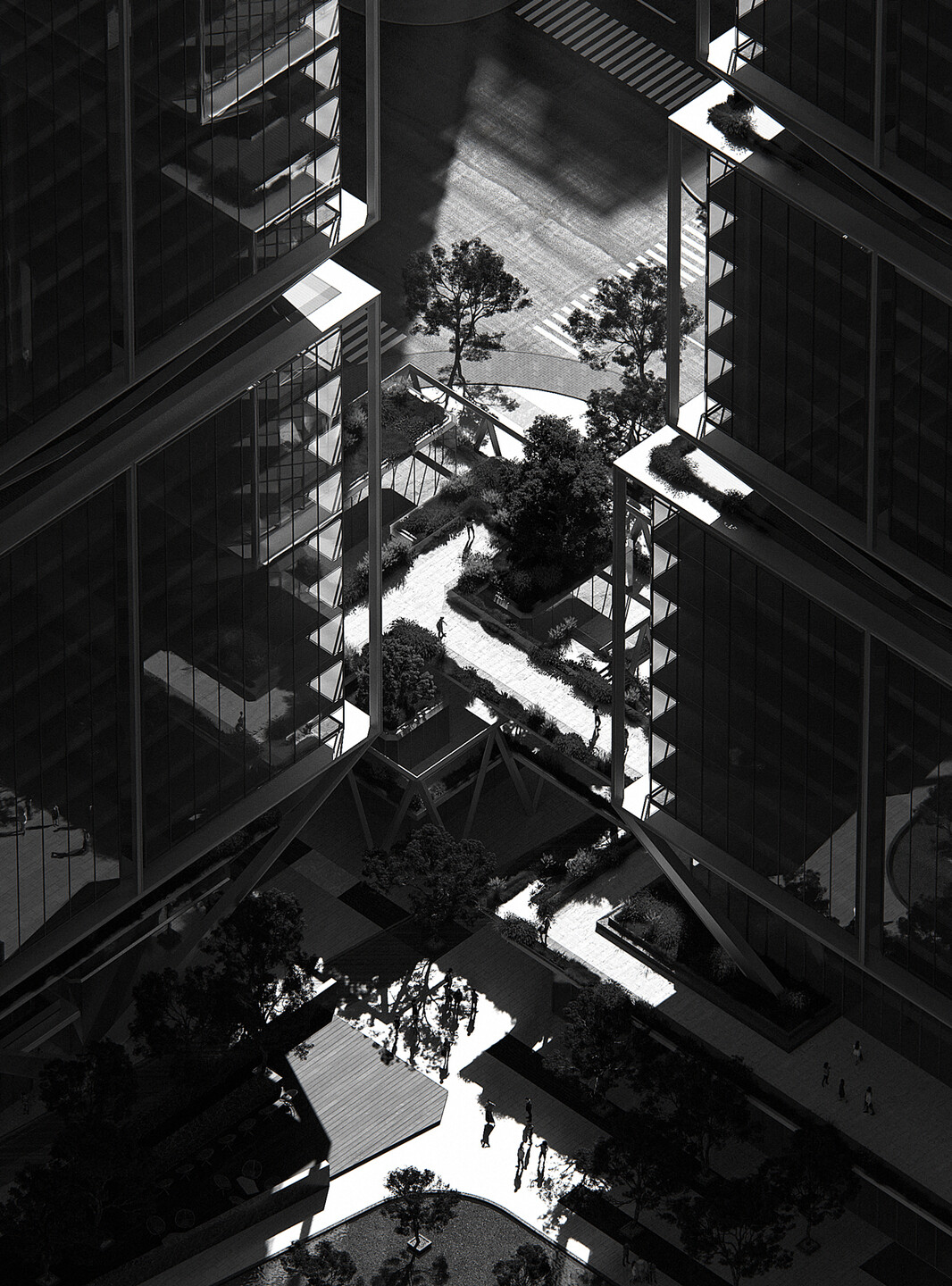
The eight towers are stacked with exposed structural blocks and setbacks, integrating two sky gardens and a rooftop garden, creating nature-friendly public spaces for high-rise users.

| Open: Place Spirit and Vitality Connection
"Openness" is the core strategy that runs through the design and the ultimate goal of the spatial design. By making the space accessible to city residents, surrounding communities, and the users on site, we aim to foster richer interactions and diverse vitality.
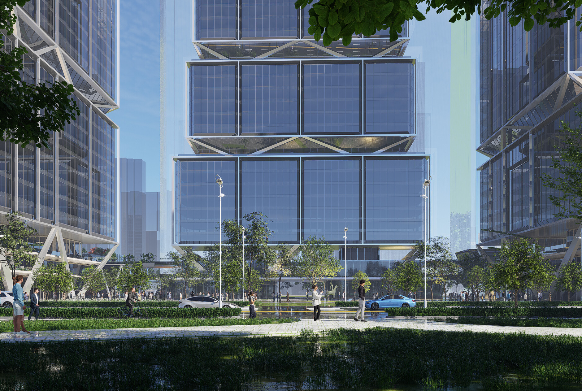
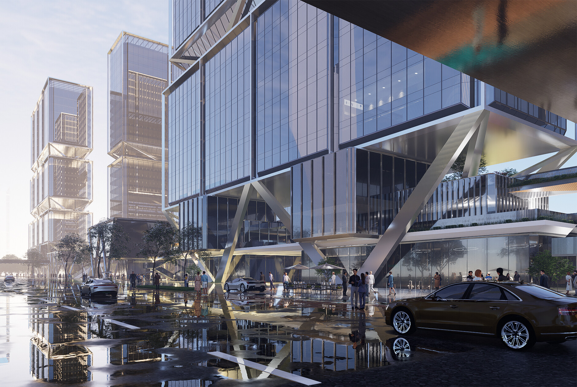
This openness not only brings more opportunities for business but also offers a variety of recreational spaces and urban landscapes. It injects new content into the urban openness of Wuchang Riverside, turning the architectural cluster into a vibrant, shared, and communicative spiritual coordinate space, rather than just an image.

New Ideal Prototype for Waterfront City Coordinates
The significance of coordinate architecture lies not in its form, scale, or height, but in its energy density of vitality and the intrinsic expression of urban spirit. Under the open proposition of "Waterfront City Coordinates," we have envisioned an ideal prototype—one that blends with the city, fits harmoniously within the block, connects with nature, and is born from daily life.
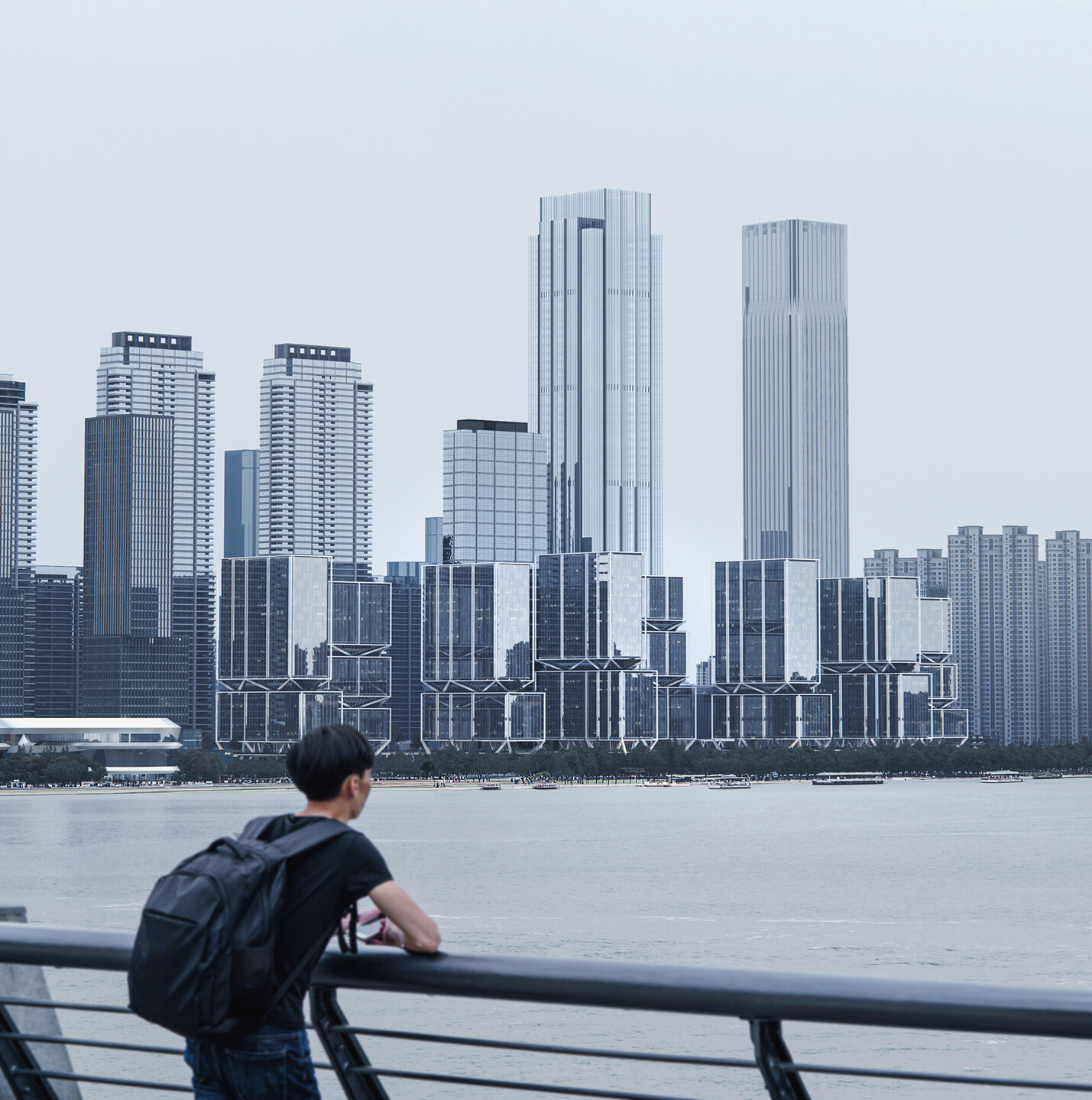
Through a group-style layout and the concept of a multi-level, fully open urban living complex, we aim to transform the static symbolism of traditional coordinates into a dynamic, experiential spatial domain shared by future businesses, users, and citizens. The tower cluster unfolding along the river will form a "Yangtze River Screen," with its crystalline skin reflecting the vitality of the city and the river view. The structural tapering between the forms evokes the "hundreds of ships and thousands of sails" on the river, preserving urban memory in the context of modern life.
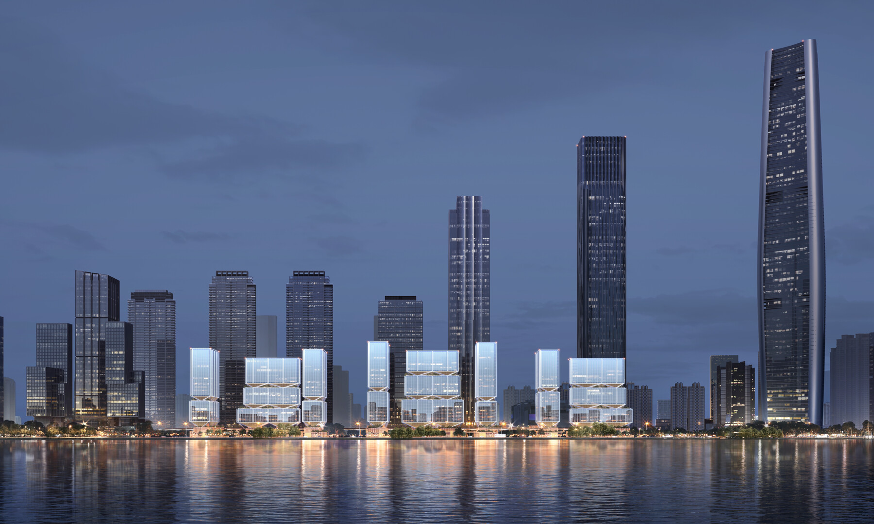
In mid-2024, with the project owner, China Resources Land, entrusting line+ with a new scheme design based on the space layout confirmed by the owner, we were presented with a meaningful opportunity to move the concept of "Waterfront City Coordinates" from blueprint to practice.
Project Name: Wuhan Great River Center Plot C International Competition
Design Firm: line+ studio
Chief Architect/Project Principal: Zhu Peidong
Design Team: Wu Haiwen, Wang Jun, Zhong Yifen, Jiang Yuan, Cai Xianghang, Zhang Yi, Zhang Zhen, Chen Puyu
Client: China Resources Land
Project Location: Wuhan, Hubei
Building Area: 207,000㎡


